
NEW ORLEANS —
New Orleans Latest Weather Forecast
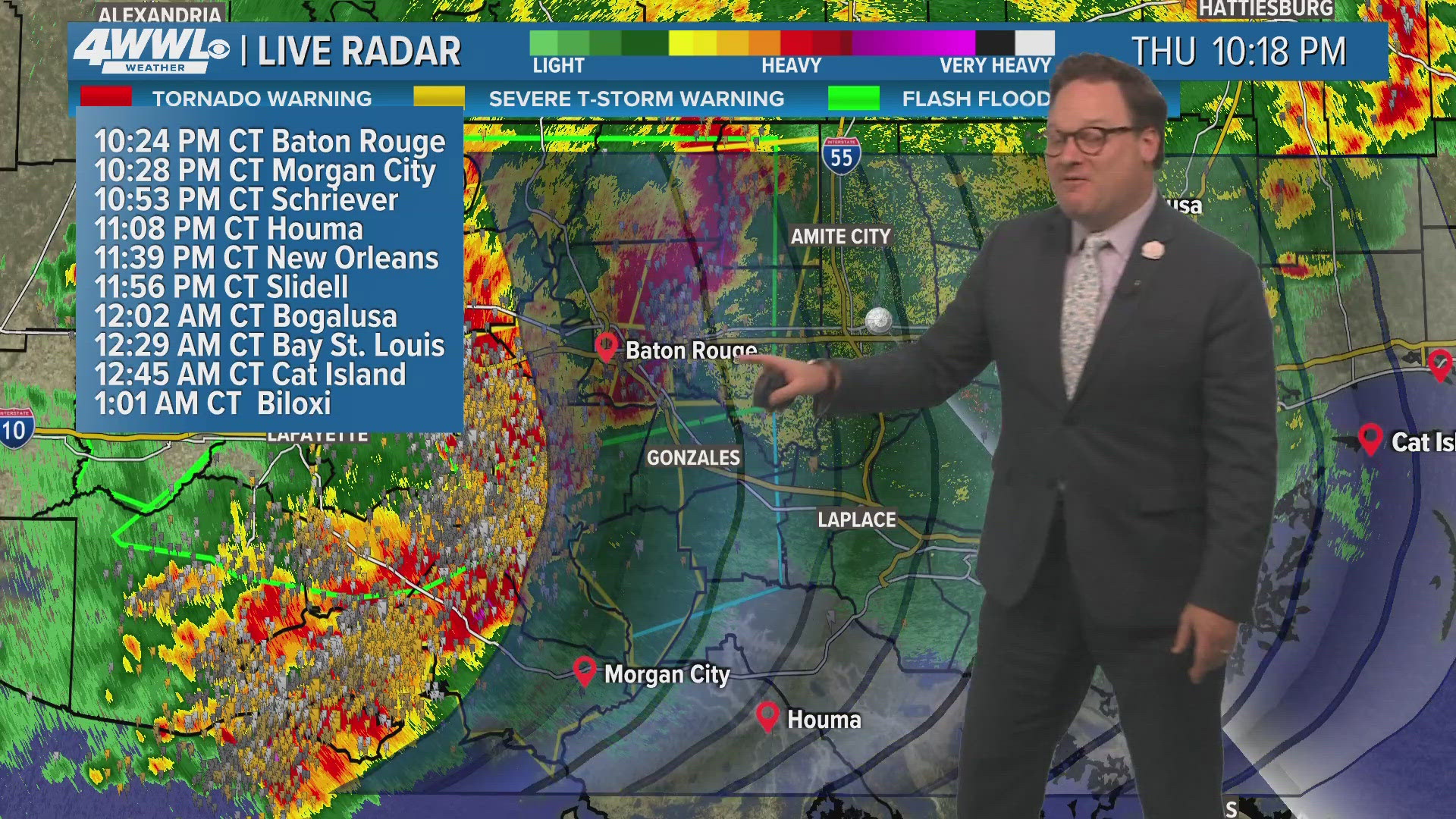
Several rounds of storms will be rolling through the area beginning late Thursday evening into the early hours of Friday, again during the day/evening Friday, and finally early Saturday. Precise timing will be near impossible until the complex of storms develop. Impacts seem greatest from strong winds, but an isolated tornado and hail cannot be ruled out. Also, heavy rainfall could lead to flooding and this may be more of a concern to our saturated ground on the Northshore and high rivers.
We thankfully will dry out, but heat up for Sunday. An upper ridge will send temps well into the low 90s and with higher humidity, heat indices near and above 100°.
Detailed Forecast:
TONIGHT:
Late evening storms. Most North. Some heavy downpours, strong winds. Low: S 74, N 72. Winds: SE 10-20+.
FRIDAY:
60-70% numerous storms. Breezy. Some heavy rain, possibly strong to severe storms. High: 87. Winds: SE/S 10-20+.
SATURDAY:
60-70% numerous storms. Breezy at times. Low: S 73, N 69. High: 86.
SUNDAY:
Mostly sunny. Hot and humid. Low: S 73, N 69. High: 89.
MONDAY:
Mostly sunny. Hot and humid. Low: S 73, N 68. High: 91.
TUESDAY:
Mostly sunny. Hot and humid. Breezy. Low: S 73, N 69. High: 91.
WEDNESDAY:
Sun to partly cloudy. Hot and humid. Breezy. Low: S 75, N 71. High: 92.
THURSDAY:
Sun to partly cloudy. Hot and humid. Breezy. Low: S 76, N 73. High: 91.